The survey covered the entire area of the Città dello Sport complex in the Tor Vergata neighborhood of Rome and was carried out using two different technologies that provide point clouds: static laser scanner survey and survey by aerial photogrammetry.
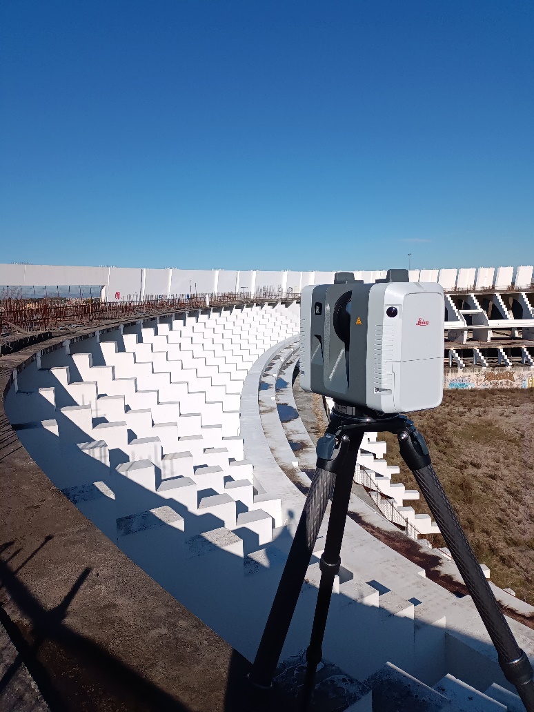
The first survey conducted was of the built structure; two tripod-mounted static laser scanners were used, each taking a 360-degree scan and photo from a fixed point.
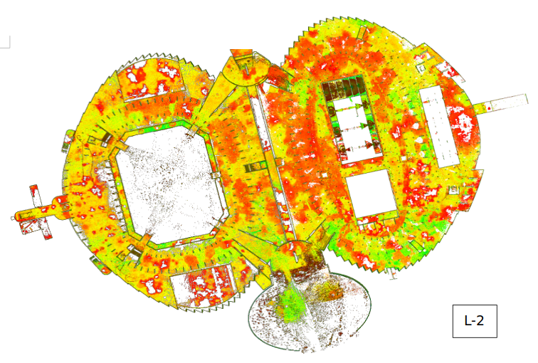
The survey covered all floors of the building, the scans started from the upper L2 level and continued to the L-2 level, the exterior of the structure was then surveyed, the L0 and L-1 levels of the outdoor pools, and the archaeological artifacts outcropping in the areas surrounding the building. A total of 978 fixed stations were carried out.
The results are colorful point clouds, except for the basement rooms without natural light (L-2 swimming pool hall and part of L-2 sports hall) where no photos could be taken, with almost no “noise” therefore sharper and higher quality, rich in detail.
The entire survey was then georeferenced through the use of 37 ground targets close to the built structures plus others scattered throughout the lot; these were “measured” by total station and georeferenced with GNSS station. The targets bordering the structures, in addition to georeferencing the point clouds generated by the static scanner, were used for the coupling between the two surveys: static laser scanner and photogrammetry.
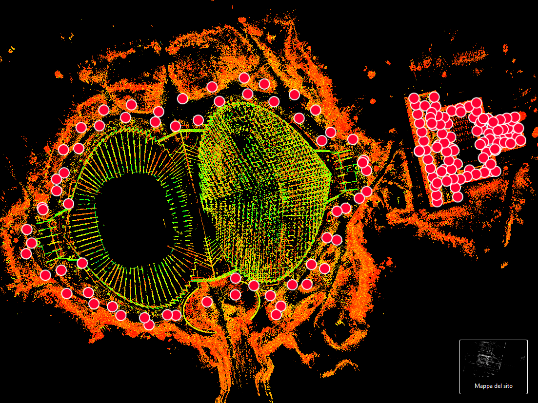
Survey of Calatrava’s Sail
The second technology used for the survey was photogrammetry: two remotely piloted vehicles (SAPRs) were used that flew, via flight plans, over the entire area. The latter was divided into 9 sectors, 2387 high-resolution zenith photos were taken.
All photos were checked and processed using SfM (Structure from Motion) software to generate point clouds, orthophotos, digital surface model (DSM) and digital terrain model (DTM).
Another drone was used for the inspection survey part of the steel structure of the sail, taking high-resolution photos from different positions around the sail.The point cloud generated by the laser scanner, that generated by photogrammetry, digital terrain and surface models, and orthophotos were needed to provide a certain basis for the subsequent BIM modeling phase of the entire area.
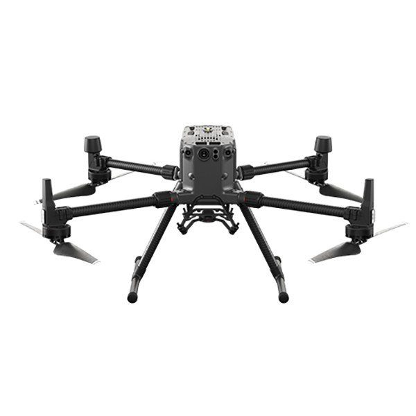
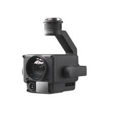
Drone for aerophotogrammetric survey
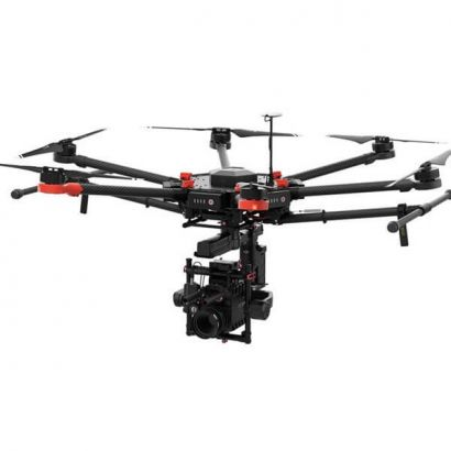
Two remote-piloted aircraft were used: a MATRICE 300 and a MATRICE 600 from DJI both with RTK correction. The DJI MATRICE 300 RTJ was used for the inspection surveys on the steel structure of the wing and mounted a DJI ZENMUSE H20 sensor. This hybrid camera is very versatile because it has a triple sensor: 20MP zoom camera, 12MP wide-angle camera, 1200m LRF.
Thanks to H20, it was possible to automate inspections of the steel structure, obtaining results at a very high level of detail.
The survey with static instrumentation was carried out with two Leica RTC 360 laser scanners, this instrument integrates an extremely powerful laser pump capable of measuring two million points per second with an advanced HDR image capture system (a technology that extends the dynamic range of an image and shows details in shadow and light, allowing the creation of images that are as close as possible to the actual amount of light present in a specific scene, i.e., it creates and manages images with a high “Dynamic Range”).
| Cookie | Duration | Description |
|---|---|---|
| cookielawinfo-checkbox-others | 1 year | Set by the GDPR Cookie Consent plugin, this cookie stores user consent for cookies in the category "Others". |